Making "Recalculating"
Finally, I found a location I liked. So I entered a street address into the GPS and gave it the name "January 1st". I tried a variety of starting points until I found one that made the route look good. And I took several screen snapshots along the way.
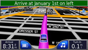
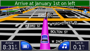
As you can see, the destination flag obscures the name "January 1st". So I moved the destination a bit and tried again. The result I liked the best was this one:
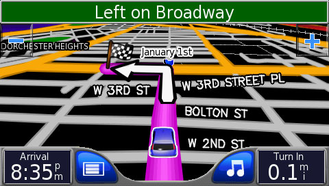
One nice thing about this image is the fact that it contains all of the letters I'd need to spell out the month names I cared about. I did need to change the title bar to say something more interesting; it turns out that the font is just standard Helvetica, so that was pretty easy.
I also changed the arrival time to 2009 and the upcoming direction to be "0.1 dy" (for "day") rather than being a unit of distance.